Use APKPure App
Get Andmap old version APK for Android
Andmap - cartographie de champs, de collecte de données et de gestion de projet en ligne
Andmap - Field Mapping, Data Collection and Online Project Management
Core Features:
• Work offline - no internet connection required
• Real-time sync capability when internet available
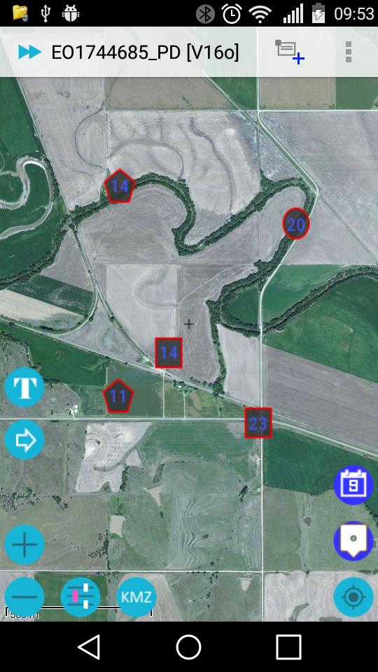
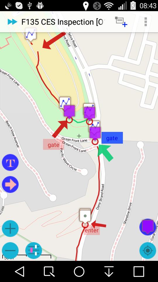
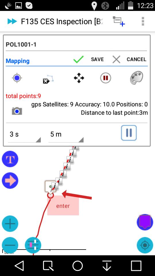
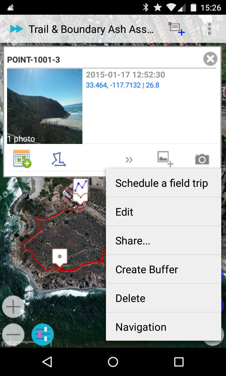
• Mapping, collect data rich points, lines, polygons, and custom overlay - text or image
• Control color / style of polyline, polygon by attribute data
• Control icon of point, polyline, and polygon by attribute data
• Move whole object, or individual point
• Map annotation - Label / Arrow, Image Overlay - Crop photo
• Divide Polyline at a point
• Make copy of object
• KML / KMZ viewer
• Dynamic create Label image for KMZ image overlay
• Integration with 3rd party annotation tool
• Customize Data Collection Forms - attribute data
• Geo-tagged photo integrate with compass
• Task Management - see detail: http://blog.andmap.co/task-management-2/
• Position Averaging - calculating an average coordinate
• Auto Track - Auto record point, line, or polygon
• Offline Maps: Streetmap / topo or imagery base map
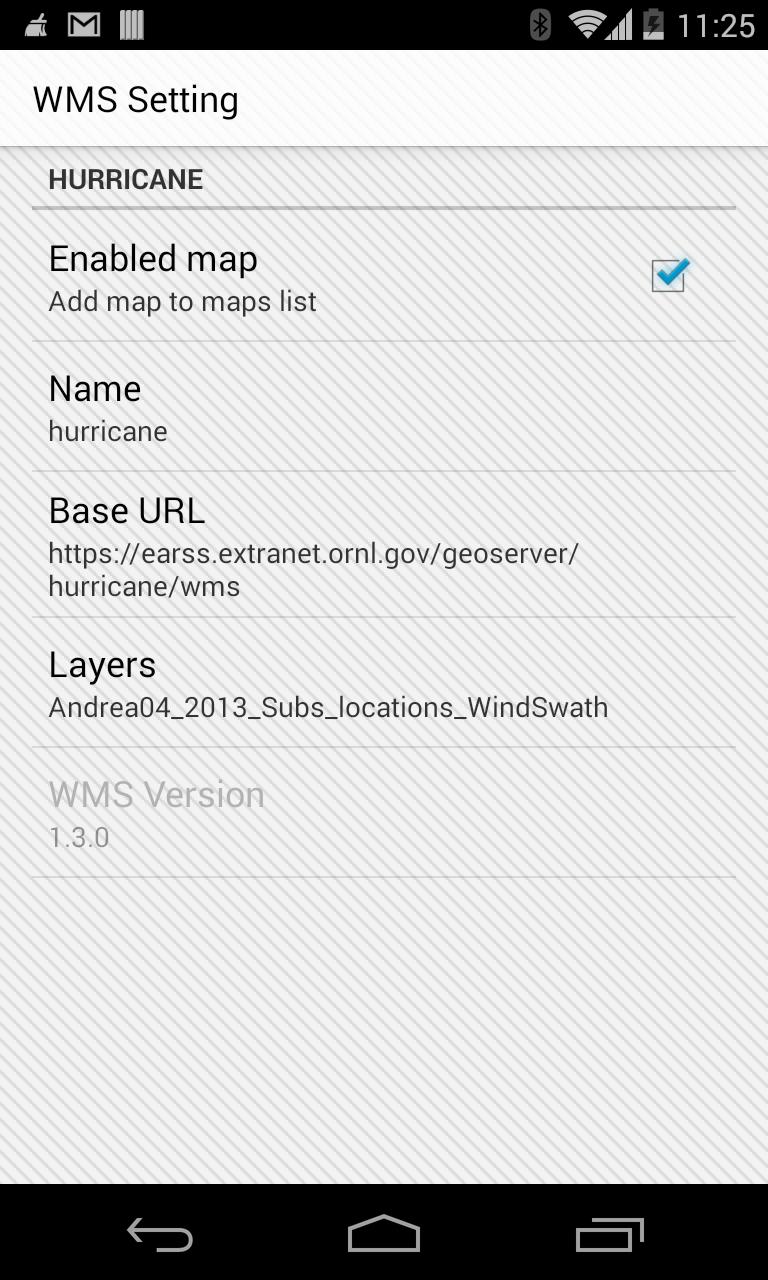
• WMS Viewer - Web Map Service
• Create Offline Maps directly from your device
• Share data in KMZ to cloud server, Dropbox, Google Drive...
• Import KMZ - images, icons, custom overlay, map annotation and attribute data
• Review | Edit | Export your data online
• Interface to your GIS - Shapefile, KML, KMZ, CSV, and GPX
• Daily work log
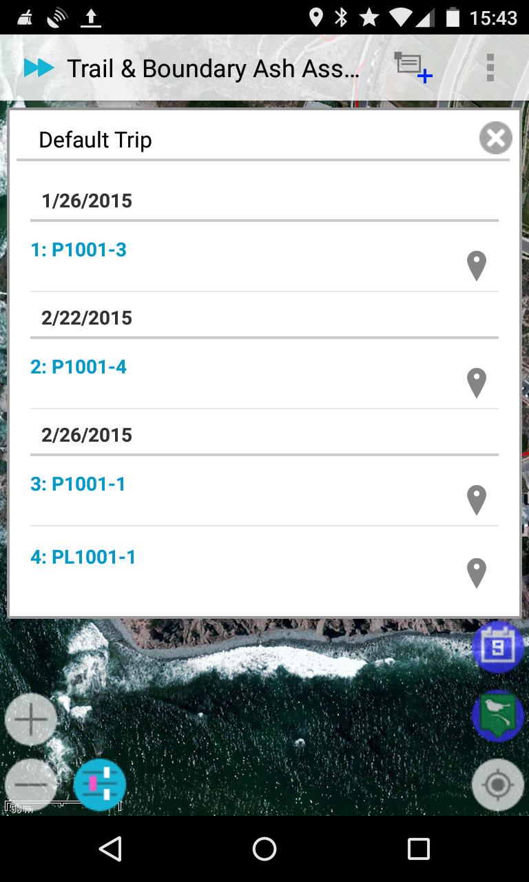
• Field trip planning - Schedule
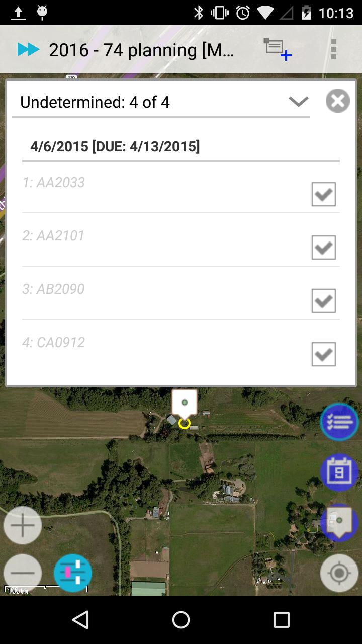
• Task Management
• 0.1 meter accuracy in mapping
Targeted at GPS/GIS mapping professionals in industries such as Telecom, Oil / Gas, Forestry, Utility, Agriculture, Environmental and other natural resource industries in addition to local, state and federal government users.
Templates:
• CES Inspection
• Groundwater Monitoring
• Predictive vegetation mapping
• Soil Sampling
• Routine Wetland Determination
• Archaeological Survey
• Vehicle Inspection
• Waste Inventory Tracking
• Utility Pole
• Sediment Sampling
• Stream Side BIO Survey
• Pipeline Marker
• Well Inspection
• Home Inspection
• Well Inspection
• Pipeline Inspection
• Property Inspection
• Sewer / Manhole Assessment / Inspection
Benefits:
• Improved data quality and provide more complete data.
• Improved efficiency and minimized site revisits.
• Improved interface to the GIS.
• Will facilitate the collection of more data more quickly and thus increasing the usefulness of the GIS.
• Easier to use user interface that requires less training.
Last updated on Jan 19, 2020
Fixes: Permission
New Map Source: Landscape Map
Customized Pipeline
filtering data
Custom Icons
Map Annotation
Push Notification
Dynamic custom map icon
KML / KMZ viewer
Add / Replace saved location
Large data - KMZ import
Map Annotation
Create Image for Overlay
Custom Overlay - Text or Image on top of Map
Position Averaging
Line Style, Line Width, Z-Order
Improved Moving Point
Field Trip Planning
Task Management
Conditional Forms
Geo-tagged photos in mapping mode
Auto Track
Dernière version
![]() 2.3.0.6
2.3.0.6
Telechargé par
Angel Ramrez
Nécessite Android
Android 6.0+
Catégories
Signaler

Discover what you want easier, faster and safer.

Andmap ULTIMATE
2.3.0.6 by ANDMAP LLC
Jan 19, 2020