Use APKPure App
Get GeoMax X-PAD Survey Trial old version APK for Android
Logiciel pour l'enquête, et le contrôle stakeout avec le GPS et la station Total.
The software for survey, stakeout and control, ensuring productivity and flexibility in the field, provides perfect integration between measure tools.
X-PAD Survey brings the best technologies to topography: integration of your data with the maps, camera for augmented reality, direct data exchange with cloud platforms, advanced graphics, use of sensors and much more.
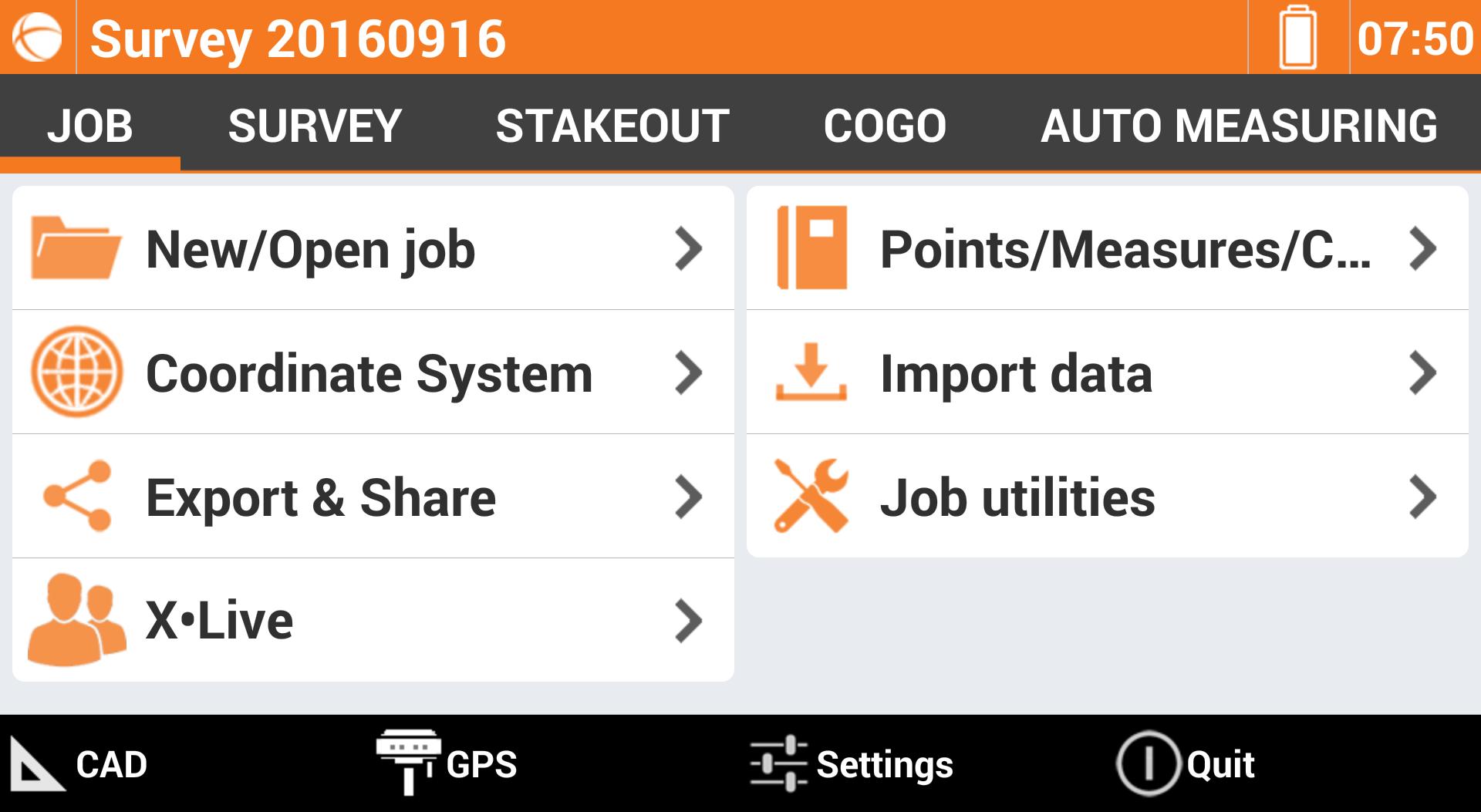
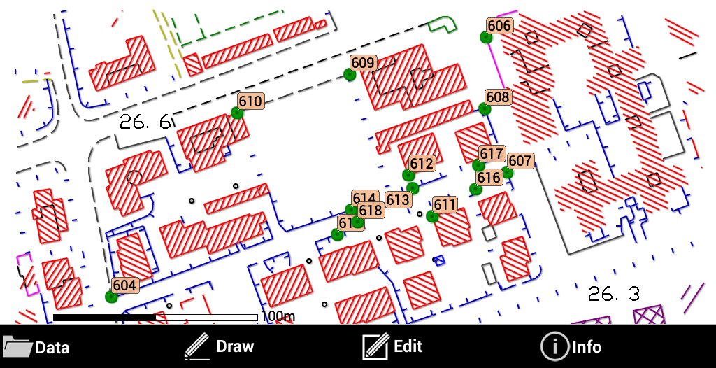
A topographic CAD
X-PAD includes a real topographic CAD, not just a simple graphic viewer, with specific functions to draw, edit and calculate the position of new elements that can be then used in the stakeout operations.
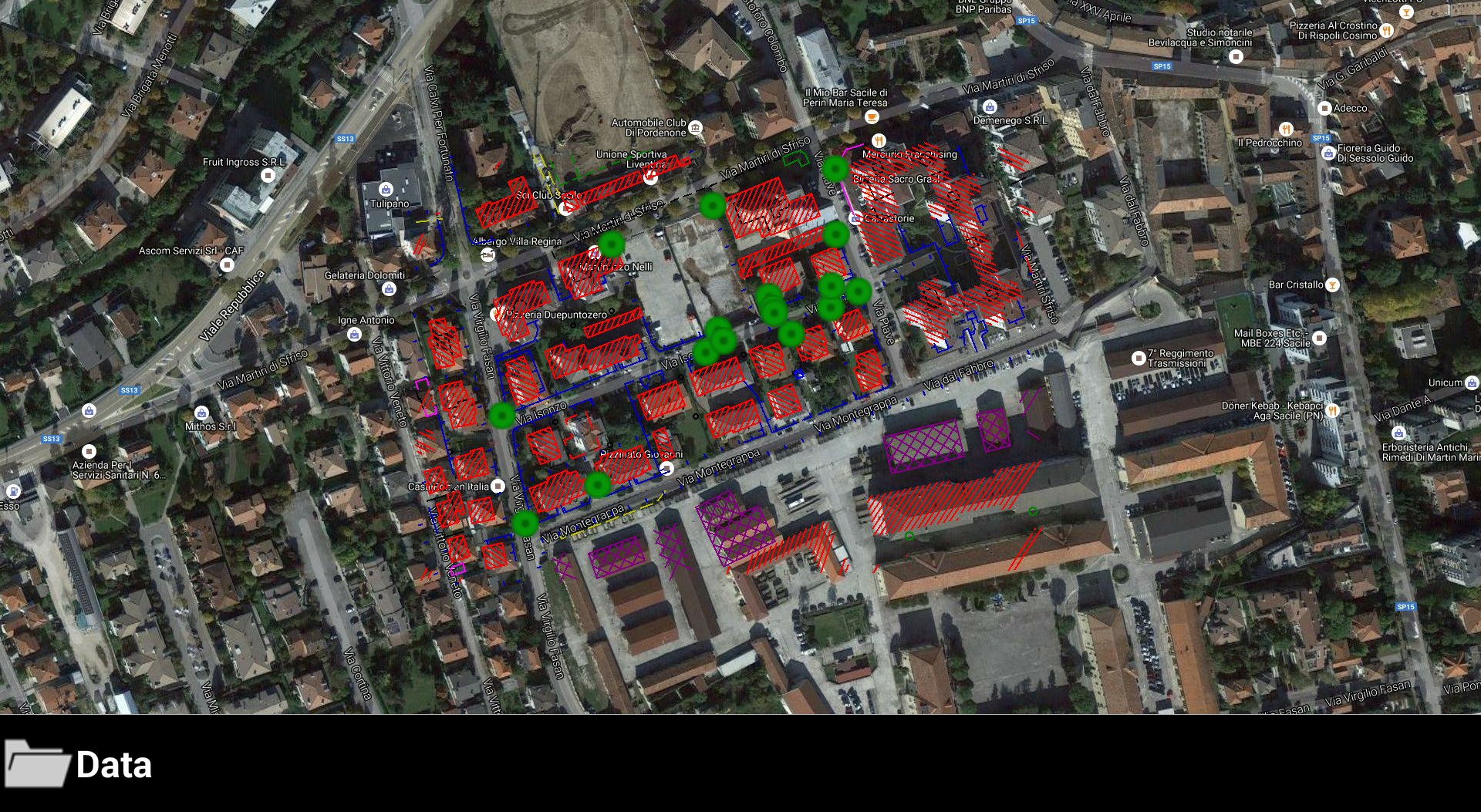
Maps, WMS and off-line mode
X-PAD allows you to use different types of maps as a basis references for the survey and stakeout activities so you can see all of your data overlapped to a map. You can choose between Google maps, Bing, OpenStreet and many others. On the main maps you may overlap the WMS (Web Map Service) maps, provided by government agencies or other offices, that represent additional elements typical of the area and specifically interesting for your surveying activities.
Augmented Reality. Turn on the reality!
How can augmented reality be a useful tool in topographic surveys and stakeout? Point the camera to the site and you can see immediately where the points and elements are for stakeout.
Cloud and sharing point.
With X-PAD you can open and import any file, even if it is in the cloud. You can save your data on the most popular cloud platforms, like Google Drive, Microsoft OneDrive and Dropbox, and access from the field or office.
Automatic update
X-PAD updates itself, so you're always sure to use the latest version with the latest news and the latest updates.
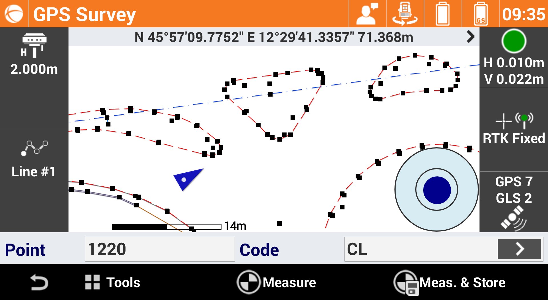
Data collections. Not only coordinates.
Measuring the position of the points is the main purpose for which we use the topographic equipment, but with X-PAD you go further because you can integrate to the position, photos, notes and voice comments - all information that in the office can be useful to create the final drawings or for the design phases.
GIS: to record all the information you want
The integrated GIS module allows you to create your GIS features and to define the corresponding attributes that can be filled when the point is stored. So you can record much more information that can be exported in standard GIS formats.
SmartDrawing: measure and draw together.
Do you think that measurements and automatic designs together are pure fantasy? Not with X-PAD. The innovative automatic design system with survey codes allows you to see the survey drawing compose point after point without requiring lengthy and complex coding.
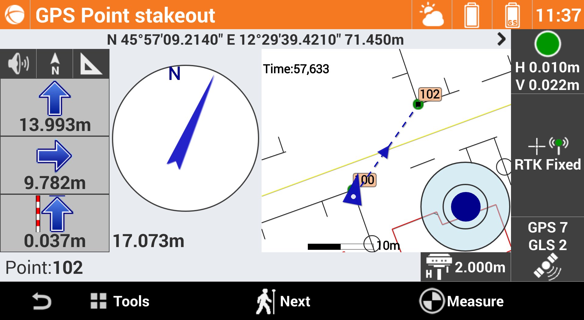
Stakeout… with your eyes closed
With X-PAD stakeout has never been easier or faster. Voice guidance allows you to arrive at the point without even looking at the display while the large compass simplifies visual navigation. Next indication, reference north or the sun directs you to the precise point without hesitation allowing the user to stakeout the design rapidly.
Terrain models and volumes
With the Volumes module, X•PAD can calculate terrain models from the points with the options to define breaklines and boundaries. You can also import models from DXF or LandXML files. Use the stakeout command to determine, in field, the design elevation wherever you are.
Roading. The whole project in the controller.
The Roading module allows you to load, manage and perform alignment stakeouts of works such as roads, highways and canals. The management is fully visual, so you always know what you're doing. You can stake all elements of the work (axes, edges, sideslopes, walls, ditches, etc.) at any station and with any offset, using the cross-sections, the edge polylines or by defining one or more sections template.
Last updated on May 26, 2017
Minor bug fixes and improvements. Install or update to the newest version to check it out!
Dernière version
![]() 3.0.608
3.0.608
Telechargé par
Jackson Campos De Jesus
Nécessite Android
Android 2.3.4+
Catégories
Signaler


Discover what you want easier, faster and safer.

GeoMax X-PAD Survey Trial
3.0.608 by LSE S.r.l.
May 26, 2017