Use APKPure App
Get Nepal Forest Fire Detection and Alert old version APK for Android
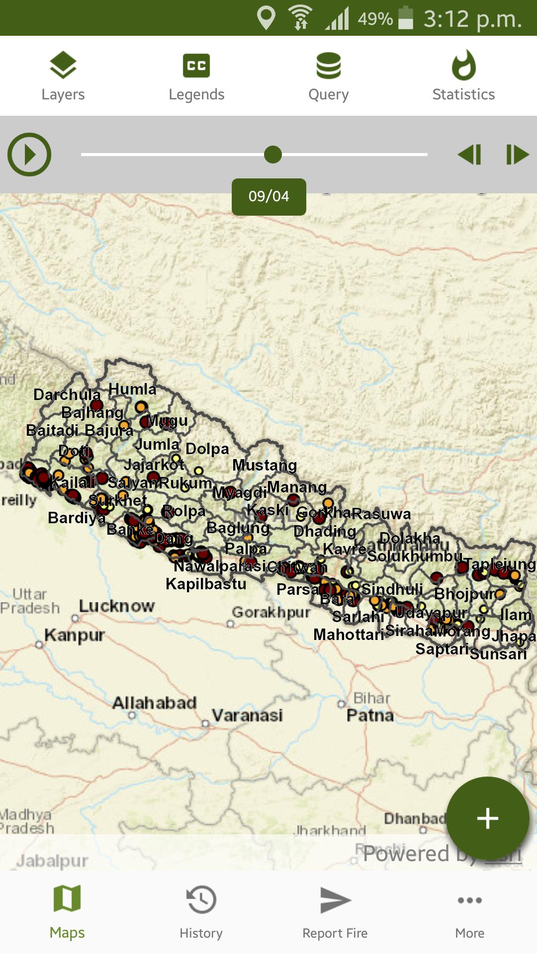
Visualization of fire locations on any given day or in a specified time period.
Forest fire has adverse ecological and economic effects and is a major concern in many countries including Nepal.
A reliable and timely fire detection and monitoring system is an important component of forest fire management.
In view of their large-area repetitive coverage, satellite data are useful for near real-time fire detection, monitoring, and burnt area assessment.
Further, the Moderate Resolution Imaging Sepctroradiometer (MODIS) sensors on board Terra and Aqua satellites of National Aeronautics and Space Administration (NASA) are already used extensively for the purpose across the globe.
ICIMOD, in close collaboration with the Department of Forests of Nepal, has developed a forest fire detection and monitoring system for Nepal based on Moderate Resolution Imaging Spectroradiometer (MODIS) data.
The work was supported by the United States Agency for International Development (USAID) and the National Aeronautics and Space Administration (NASA) under the SERVIR-Himalaya initiative
The system carries out automated data acquisition, processing, and reporting on fire location.
It provides location information at 1x1 km resolution on active fires present during the satellite’s twice-daily overpasses.
The system assimilates active fire data generated by ICIMOD’s MODIS receiving station that adopts NASA’s fire detection algorithm.
To these data the system automatically adds important information such as administrative unit (i.e. district, VDC, and ward number), protected area identification, land cover type, elevation, and slope.
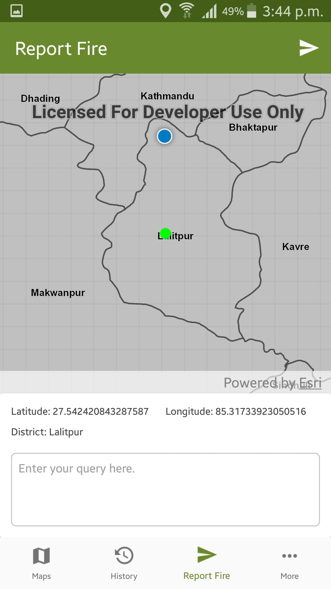
The system currently sends notification on fires throughout Nepal to some 180 subscribers. Furthermore, some 220 text message subscribers, including District Forest Officers and focal persons of the Federation of Community Forestry Users (FECOFUN) in all districts of Nepal, receive fire alerts in their mobile telephones if a fire incident is detected in the district of their subscription.
The information is also published through this web mapping application.
This application allows dynamic visualization of fire locations on any given day or in a user-specified time period.
For further information contact:[email protected]
Mountain Environment and Natural Resources’ Information System
International Centre for Integrated Mountain Development
http://www.icimod.org
http://geoportal.icimod.org
Dernière version
![]() 1.0.3
1.0.3
Nécessite Android
4.1 and up
Catégories
Signaler
Last updated on Nov 8, 2017
Minor bug fixes and improvements. Install or update to the newest version to check it out!
Discover what you want easier, faster and safer.


![Comment télécharger la dernière version de Google Play Store APK 42.0.20-23 [0] [PR] 654119317 pour Android 2024](https://image.winudf.com/v2/image/YWRtaW5fR29vZ2xlLVBsYXktU3RvcmUtNi4xLjEyLUFQSy5wbmdfMTUxMzA2Nzg1ODQzOQ/banner.jpg?fakeurl=1&w=192)


Nepal Forest Fire Detection and Alert
1.0.3 by icimod
Nov 8, 2017